


Storm Conor to follow Storm Barbara
The second named storm of the season, Storm Barbara, which is bringing gales and squally rain to the UK today, is being followed by Storm Conor on Christmas Day and Boxing Day.
Those travelling today could face some travel disruption from Storm Barbara.
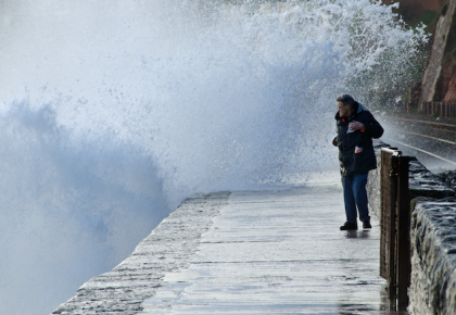
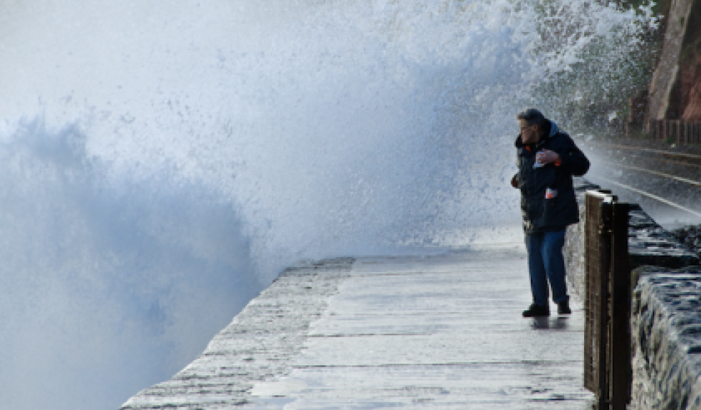
An Amber wind warning is in place for northern and western parts of Scotland for this afternoon and evening and two separate yellow wind warnings, one covering more northern areas where gusts of 60 to 70 mph are expected quite widely, and another covering parts of northern England, the South West and Wales where an intense, fast moving band of heavy rain and gusty winds could lead to some disruption with gusts of 50 to 70 mph.
Wintry showers, strong winds and lightning could lead to disruption to power supplies and travel for northern Scotland where there is an ice and snow warning and even if you are outside the warning area you could see some windy weather although disruption is less likely.
National Severe Weather Warnings are also in place for northern parts of the UK for Christmas Day and Boxing Day as a new low pressure system, named Conor, crosses to the north of the country bringing more strong winds and gales.
Deputy Chief Meteorologist, Dan Harris said: "The wet and windy weather is a result of two deep Atlantic low pressure systems crossing the Atlantic and passing close to the northwest of the UK bringing the potential for some disruption to power supplies and travel, and possibly structural damage.
“Although we need to be prepared for Storms Barbara and Conor, it’s important to note that there will also be some less unsettled weather for many on Christmas Eve and Christmas Day.
"Whatever your plans over the next few days it's worthwhile staying up to date with the latest Met Office forecasts."
Storm Conor is expected to bring gusts of 50 to 60 mph over Northern Ireland and northern England and up to 70 mph to parts of Scotland on Christmas Day. The greatest impacts are expected to be over the Northern Isles on Boxing Day where the potential for gusts in excess of 80 mph enhances the risk of disruption to power supplies, with large waves affecting coastal areas.
Scottish Transport Minister Humza Yousaf said: “Our transport operators and trunk road operating companies are working hard to keep services and roads running, safety has to be our top priority so we are seeing delays and cancellations to flights and ferries.”
From Tuesday 27th December onwards indications are that high pressure will once again start to dominate our weather bringing more settled weather with the risk of overnight fog for southern areas while parts of the north remain blustery.
If you're spending Christmas in Devon, the five day regional forecast is as follows:
This Evening and Tonight:
This evening in the wake of Storm Barbara skies will clear giving a chilly night with just a couple of showers. It will stay windy overnight, but this should prevent too much frost from forming. Minimum Temperature 4°C.
Saturday:
After a bright and chilly start on Christmas Eve it will tend to turn cloudier through the day. It should stay dry though but windy throughout. Maximum Temperature 11°C.
Outlook for Sunday to Tuesday:
Christmas Day will start mild but windy with rain arriving later. Boxing Day will be brighter and drier but windy. By Tuesday winds ease giving a calmer, brighter day.