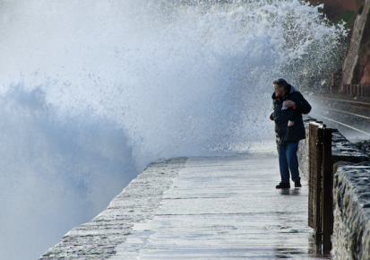


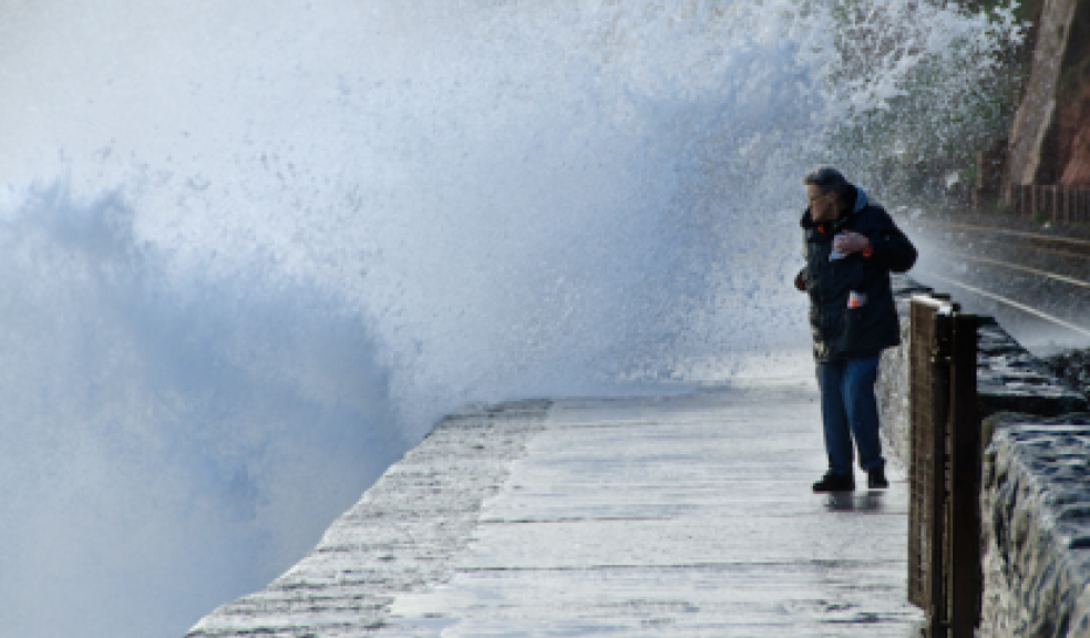
Storm Imogen batters Devon
Police are advising motorists to take extra care on Devon's roads as Storm Imogen passes through the region.
Gusts of up to 80mph have brought down numerous trees, causing widespread travel disruption. Motorists are asked to drive carefully, allow extra time for their journeys and avoid all flooded areas.
High winds have also brought down power lines, leaving thousands of homes, businesses and schools without electricity.
A number of flood warnings are still in force and emergency services are urging people to stay away from the coast this evening as high tide and storm surges cause dangerous conditions.
Up to date information on traffic and travel disruption can be found on the police website (traffic watch) as well as Highways, National Rail and other sources’ websites and social media accounts. Traffic and travel updates can also be found here.
Environment Agency flood warnings are available at https://flood-warning-information.service.gov.uk
Jonathan Day, Environment Agency Duty Flood Risk Manager said: “Storm Imogen will lead to large waves and spray along the south and south-west coastal parts of England on Monday.
"We understand it is tempting to see the force of Mother Nature but people should take extreme care on coastal paths and not put themselves and rescue workers at risk.
"Please listen to the advice of the coastguard and the police about safe places to be. Flooding of low lying coastal roads is also possible and people should also avoid driving through flood water.
“There is also continued risk of minor river flooding into next week in the south and south west of England as rivers will continue to rise in response to recent rainfall Environment Agency teams, as always, are out on the ground monitoring the situation and will issue flood warnings and alerts as required.
"The public can keep up to date with the latest situation on GOV.UK or follow @EnvAgency and #floodaware on Twitter for the latest updates."
The Met Office forecast is as follows:
This Evening and Tonight:
Gales across the south will ease however it will remain windy. Further showery rain will continue to spread across many areas overnight, although central areas should become clearer and colder. Also mostly dry in northeast Scotland with a frost.
Tuesday:
Windy, with showery rain moving south, wintry over high ground, especially in the north. Sharp showers continuing across the south with gales possible, particularly in the afternoon. Colder.
Outlook for Wednesday to Friday:
Cold, easing winds and mainly dry on Wednesday and Thursday with scattered wintry showers and overnight frosts. Stronger winds with further rain and hill snow in the south on Friday.
See also http://www.theexeterdaily.co.uk/news/business-daily-local-news/storm-imo...